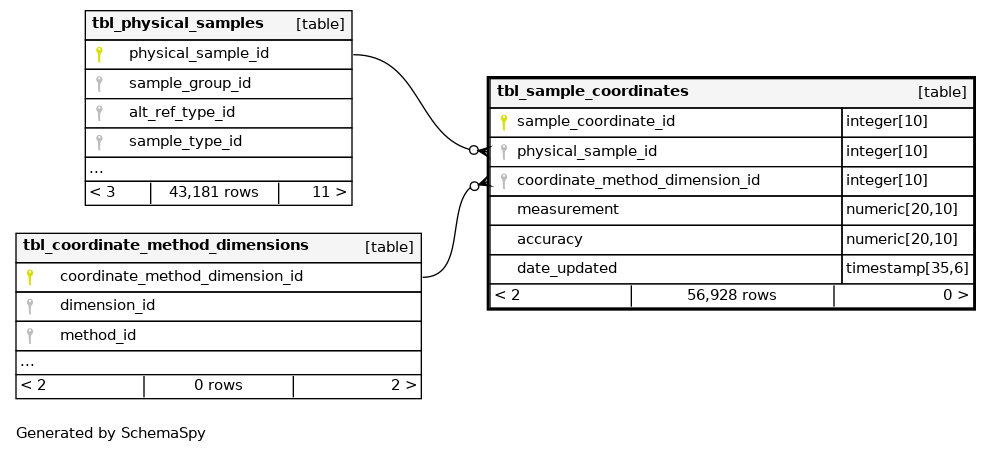
Columns
| Column | Type | Size | Nulls | Auto | Children | Parents | Comments | |||
|---|---|---|---|---|---|---|---|---|---|---|
| sample_coordinate_id | int4 | 10 | √ |
|
|
Primary key (automatically incremented). |
||||
| physical_sample_id | int4 | 10 |
|
|
Identifies the specific physical sample. |
|||||
| coordinate_method_dimension_id | int4 | 10 |
|
|
Specifies referencing the method used to determine the grid type. |
|||||
| measurement | numeric(20,10) | 20,10 |
|
|
The specific coordinate measurement value. |
|||||
| accuracy | numeric(20,10) | 20,10 | √ |
|
|
Describes the precision of the GPS data, e.g., 5m, 10m, 0.01m. |
||||
| date_updated | timestamptz | 35,6 | √ |
|
|
Indexes
| Constraint Name | Type | Sort | Column(s) |
|---|---|---|---|
| tbl_sample_coordinates_pkey | Primary key | Asc | sample_coordinate_id |
| idx_sample_coordinates_coordinate_method_dimension_id | Performance | Asc | coordinate_method_dimension_id |
| idx_sample_coordinates_physical_sample_id | Performance | Asc | physical_sample_id |
Relationships
Close relationships within degrees of separation